|
High
Sierra Essentials
The following is an overview of the essential High Sierra info.
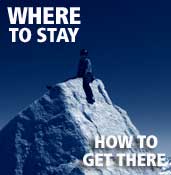
Getting
There
Car Travel
Almost all climbs are accessed off of U.S. 395 and the small
Eastern Sierra towns of Lone Pine, Independence,
Big Pine, Bishop, Tom's
Place, and Bridgeport.
Below are the general driving times (in hours) to the Eastern Sierra
(times vary depending which trailhead you are heading for):
Tuolumne Meadows: 1-3, Yosemite Valley: 2-4, Reno: 2-4, Los Angeles:
4-6, San Francisco: 5-7, Las Vegas: 4-6, Salt Lake City: 9-11, Boulder:
18-20
Air Travel
Reno/Tahoe
Airport is the closest airport to most High Sierra climbs.
From there, you will need to rent
a car and drive 2-3.5 hours
to your climbing destination. You can also fly into Los Angeles,
Oakland, San Francisco, Sacramento, or Fresno. Each of these
places requires 5-7 hour drive to the East Side.
Bus Travel
The Eastern Sierra has little bus service or public transportation.
The only town that can be reached by bus is Mammoth Lakes via the Mammoth Shuttle (760-934-3030).
When
to Climb
Almost everyone climbs in the High Sierra between June and October.
From November through April, the High Sierra is pounded with snow
from big Pacific storms.
Note: Below, the snow conditions are listed for an average snow
year. Most snow years are not average and the projections below
will be way off if it has been a heavy or light snow year. Your
best bet is to search for your climb on the route
beta page to see what the conditions are like. If there is nothing there,
ask a question in the forum.
May – Only in low snow years will climbs be easily
accessible. In general, most of the approaches will be snow-covered
and many of the access roads may not be plowed. May is mostly dry
but expect a few storms. There are no crowds in May.
June – Aside from a rare storm, June is usually dry
with warm temps and nice long days. Most of the access roads are
plowed but there will still be snow on most approaches. Thunderstorms
begin to develop so keep a close eye on the weather. The crowds
start showing at the end of June and it becomes more competitive
to get overnight camping permits. Charlotte Dome and Temple Crag
are usually the first climbs to easily access.
July and August – Prime Sierra climbing weather.
Temperatures are hot at the trailheads but perfect on the climbs.
This is also prime thunderstorm season so watch the weather closely.
There are lots of crowds and it is competitive for overnight camping
permits (get reservations at least a month in advance).
September – Still great climbing conditions but the
nights are cool. Some north-facing routes may be uncomfortably cold
in the shade. The crowds start to thin out.
October – Shorter days and cold nights mean less people.
Climbing in the shade is no fun. Weather is mostly dry but the first
winter storm can arrive late in the month. Easy to get overnight
camping permits.
November – Frigid nights and short days keep most people
out of the High Sierra. Winter storms begin to arrive more frequently.
A rare time to get some solitude before the heavy snow sets in.
December-April – Got skis? Frequent winter storms and
icy temperatures make the High Sierra only accessible to those that
enjoy suffering. In exceptionally dry years, during a warm spell,
you may be able to run up one of the peaks in-a-day in December.
Current
Road and Weather Conditions
 Tioga
Pass Weather
— Elevation 10,000 feet
Tioga
Pass Weather
— Elevation 10,000 feet
Mammoth
Lakes, CA — daily report of temperatures in Mammoth Lakes
Bishop,
CA — daily report of temperatures in Bishop
Road
conditions
— in spring, see if the road to you trailhead is plowed
Thunderstorms
and Lightning Strikes
The High Sierra has some of the best weather of any alpine rock
climbing area on earth. That said, note that the High Sierra is
still in a massive mountain range and receives severe thunderstorms
and lightning throughout the summer. Check the weather before you
climb and scope the retreat route beforehand. Most thunderstorms
originate from the west, so if you are climbing an east-facing route,
you may not see thunderstorms until they are on top of you. Always
carry rain shells.
Lightning tends to hit high points, trees, and water, but will
hit low points next to high rocks, flat areas near tall trees, and
dry land in areas with lakes. Know how to perform CPR. Unlike with
nearly any other type of injury that stops the heart, electrical
shock victims can suddenly awaken even after extended CPR, so CPR
should be continued indefinitely.
Altitude
Sickness
It takes a few days for most people to adjust to the rarefied air.
Drink lots of water and don't run around too fast if you're just
coming up from low elevations. It's a good idea to camp at least
one night at the trailhead and a better idea to spend a few days
cragging at high elevation. Tuolumne Meadows is the best place for
high altitude cragging. If you can't make it there check out some
the Eastern Sierra summer cragging areas.
Lone
Pine and Whitney Portal Essentials
Nearby Peaks: Mt. Russell, Mt. Whitney, Lone Pine Peak
Getting There: 57 miles south of Bishop. View
Map
Gear: Elevation(150 S. Main Street
(Highway 395); 760-876-4560) sells climbing and mountaineering
gear and rents crampons and bear canisters.
Groceries: Joseph's
Bi-Rite Market (119 S Main St (Highway 395);
(760) 876-4378)
Restaurants: The Pizza Factory (301 S Main Street;
760-876-4707). Mt. Whitney
Restaurant (227 S Main St; 760-876-5751)
is open 7 days a week and serves Buffalo, Ostrich, and Veggie
Burgers. Totem Cafe (131 S Main Street; 760-876-4726) has American-style
cuisine and patio dining. Season's Restaurant (206 S Main
Street; 760-876-8927) is pricey, but serves good food and large
portions. PJ's Bake and Broil (446 S Main Street; 760-876-5796) is
the classic diner in town.
Services at Whitney Portal: Don't miss the hamburgers and
french fries at the Whitney Portal Store (760-876-0030).
The Whitney Portal Store also sells tourist stuff, maps, books,
and they have a great deal on bear canisters, which you can also
rent.
Trailhead camping: It is often a good idea to camp at the
Whitney Portal before starting your climb. You will get an early
start on the hike and start acclimatizing (Whitney Portal is at
8,300 feet). There are ten walk-in sites near the trailhead (follow
signs to "Hiker Overnight Camping") reserved for hikers/climbers
that cost $15 a night and are first-come, first-served. You can also
stay at the Whitney Portal Campground but will have to shell out
$24 a night and reserve your site in advance. Go here for more info: http://www.fs.fed.us/r5/inyo/recreation/campgrounds.shtml
Independence
and Onion Valley Essentials
Nearby Peaks: Charlotte Dome
Getting There: 42 miles south of Bishop on US 395. View
Map
Groceries: There is a small market in town but your best
bet is to at Joseph's in Lone Pine or one of the three markets in
Bishop.
Restaurants: not much to choose from but the Still Life Cafe (135 S Edwards; 760-878-2555)
Trailhead camping: Onion Valley Campground is located 9,600
feet, costs $21/night (reservations
recommended by calling 877-444-6777) with picnic tables and
piped water.
Big
Pine and Big Pine Creek Essentials
Nearby Peaks: Temple Crag, Mt. Sill
Getting There: 15 miles south of Bishop. View
Map
Groceries: Carroll's Market and the Mobil Station
are limited and have the only groceries in town. Stock up in Bishop,
which is only 15 miles north on US 395.
Restaurants: Rossi's Place (102 S Main St: 760-938-2308) pizza and cocktail bar.
Services at Big Pine Creek: Glacier
Lodge(11 Miles West of US 395; 100 Glacier Lodge Road; 760-938-2837) has cabins
for $159/night that sleep 2-9, a general store, and a restaurant.
$4 showers are available between 10 a.m. and 4 p.m. Glacier Pack
Train (0.5 mile east of Glacier Lodge; 760-938-2538) provides
pack trips into the backcountry.
Trailhead camping: Big Pine Creek Campgroundand Upper Sage Flat Campground are located along Glacier Lodge
Road at 7,700 feet and have picnic tables, rest rooms, and water.
Both are $23/night (reservations recommended by calling 877-444-6777). If you are
up for hiking in a mile on the North Fork trail to First Falls, there is a free walk-in
campground with picnic tables, fire rings, and pit toilets (your
must get your own water from the creek).
Bishop
and South Lake Essentials
Nearby Peaks: Mt. Goode, Mt. Emerson, Mt. Humphreys, Cardinal Pinnacle
Getting There: 2.5 hours east of Yosemite Valley (when Tioga
Pass is open), 5 hours north of Los Angeles, and 6 hours east of
San Francisco. View
Map
Groceries: Vons (North Main Street) is the gigantic
grocery store located next to K-mart, Joseph's BI-Rite Market
is in the center of town, across from The Gear Exchange, and Manor Market
(3100 West Line Street) has a great beer and wine selection as well
as a deli and basic groceries.
Restaurants and Cafes: The Black Sheep (232 North Main Street; 760-872-4142) is
an excellent local coffee shop and a perfect
rest day hang out. Across the street is another
café, The Looney Bean (399 North Main
Street; 760-873-3311). Bishop has several
great places to eat. The Burger Barn (2675
West Line Street) makes delicious homemade
burgers, fries, and shakes. Jack's Waffle Shop (437 North Main Street; 760-872-7971) serves
breakfast. Schat's Bakkery (763 North Main
Street; 760-873-7156) has every type of pastry
and excellent sandwiches and bread. Thai
Thai (703 Airport Road; 760-872-2595), at
the Bishop airport, has the best and most
authentic Thai cuisine on the East Side. For
Mexican food there are three options: At
Amigos (285 North Main Street; 760- 872-
2189) try the carne asada, Taqueria Las
Palmas (136 East Line Street; 760-873- 4337)
has awesome burritos, and La Casita (175
South Main Street; 760-873-4828) has okay
food and a full bar (that means margaritas!). Whiskey Creek (524 North Main Street; 760-
873-7777) has a great bar with yummy salads,
pub food, and a sit-down dining room with
fancier choices such as filet mignon and ahi
tuna. Upper Crust Pizza (1180 North Main
Street; 760- 872-8153) has some of the best
pizza we've tasted—try the "Illusian." There is
also a Pizza Factory (970 N Main Street; 760-
872-8888).
Other: The Rubber Room (175-B North Main Street; 760-872-1363) is the best place anywhere for quality resoles. There
is a Bank of America, Chase Bank, and Union Bank of California
in town. The Bishop Twin Theatre (760-873-3575) has two screens
and new movies weekly. Galen and Barbara Rowell's Mountain Light
Gallery (106 South Main Street; 760-873-7700) has beautiful
photography of the east side and is definitely worth a visit.
Services at South Lake: There is a general store in Habbegers,
which is 3 miles from Highway 168 on the way to South Lake.
Trailhead camping: Willow Campground is located at
9,000 feet on the road to South Lake and has sites for $23/night.
Your need to get water from the creek. North Lake
Campground lies at the Mt. Emerson
trailhead, sites for $23/night, is open from June to September, and
is first come, first served. There are also several
other campgrounds located along Highway 168.
Tom's
Place and Rock Creek Essentials
Nearby Peaks: Bear Creek Spire, Petite Griffon
Getting There: 24 miles north of Bishop. View
Map
Groceries: There is a little grocery store at Tom's Place,
but for major groceries head south (20 minutes) to Bishop or north
(15 minutes) to Mammoth Lakes. Bishop has three large stores (see
Bishop "Groceries") and Mammoth Lakes has a Vons
(off Old Mammoth Road).
Restaurants: Tom's Place Resort (right off US 395) has lodging
as well as a restaurant and bar (next to the store). For
a more extensive selection, cruise down the
grade to Bishop or up to Mammoth Lakes.
Services at Rock Creek:
Rock Creek Lodge (Rock Creek Road; 877-935-4170 or
760-935-4170) has a small store and a restaurant.
Trailhead camping: Mosquito Flat Trailhead Campground is a free walk-in campground only for persons with an overnight
backcountry permit for the following day, and the stay limit
is only one night. The campground is located across the bridge
that leads to Eastern Brook Lakes. There are 12 other campgrounds
to choose from between Tom's Place and Mosquito Flat that cost
around $25 a night. Most of these campgrounds do not require
reservations. For more information, visit Rock Creek Camping
Mammoth Lakes Essentials
Nearby Peaks: Crystal Crag, Clyde Minaret, Mt. Ritter
Getting There: 30 miles north of Bishop. View
Map
Groceries: There are only two options
in Mammoth: Vons (off Old Mammoth
Road) and a small health food store, Sierra
Sundance, which is located in the Rite Aid Plaza off Main Street.
Restaurants: Black Velvet Coffee (3343 Main Street Suite F) has by far the best
coffee around. Try an americano or their
unique cold brew. Across the street, Stellar
Brew Natural Café (3280 B Main Street;
760-924-3559) offers coffee, baked goods,
and excellent breakfast burritos and lunches,
all with vegan and gluten free options. Try Roberto's Mexican Café(271 Old Mammoth
Road; 760-934-3667) or Gomez's (100 Canyon
Boulevard; 760-924-2693) for great Mexican
food and strong margaritas, Good Life Café (126 Old Mammoth
Road; 760-934-1734) for healthy food and
fresh eating options, Burgers (6118 Minaret
Road; 760-934-6622) for awesome burgers
and fries. For pizza, there is Z Pizza (26 Old Mammoth Road; 760-934-5800) or Nik-N-Willie's (100 Old Mammoth Road;
760-934-2012).
Camping: The Mammoth Lakes Basin
has five campgrounds that put you in close
proximity to Crystal Crag. Twin Lakes
Campground is open the longest in the
summer and costs $23 per night. Sites can
be reserved ahead of time by calling 1-877-
444-6777. Lake Mary Campground, also
$23 per night, can be reserved online. For
campsites that serve as a launching pad for
Clyde Minaret or Mt. Ritter, there are seven
forest service campgrounds near Devil's
Postpile. Agnew Meadows Campground and Reds Meadow Campgroundare the most
convienient and cost $22 per night, but also
require a $7 fee for riding the shuttle past the
Devil's Postpile Entrance Station.
Alternatively, there are a few campgrounds
right as you arrive into town, such as New and Old Shady Rest Campgrounds. They are less
scenic than the Lakes Basin sites, but incredibly
easy to access, and cost $22 per night.
Tuolumne Meadows Essentials
See our Tuolumne Meadows Beta Page
Bridgeport
and Twin Lakes Essentials
Nearby Peaks: Incredible Hulk, Matterhorn Peak
Getting There: 90 miles north of Bishop. View
Map
Groceries: There is a small market in town.
Restaurants: There a number of cafes
and restaurants in town.
Services at Twin Lakes: The Twin
Lakes Resort (760-932-7751) has a small store and a restaurant
that serves great burgers.
Trailhead camping: Mono Village Campground (760-932-7071)
at 7,100 feet is $22/night. Lower Twin Lakes Campground (760-932-7070)
is at 7,000 feet and $24/night. Honeymoon Flat Campground (760-932-7070) is at 7,000 feet and $18/night.
Backcountry
Camping Permits
When camping overnight in the backcountry,
you always need a permit, which can be picked
up at one of the ranger stations listed below
(sorry, no mail order permits). A quota system
is in place in the summer and fall, which
means only a limited number of permits are
issued each day. Of this number, 25-40 percent
are available on a walk-in basis for free at
the ranger station the day before you plan to
leave, and 60-75 percent of the permits can
be reserved in advance for a fee. Most of the
classic Sierra climbs are accessed off popular
trails where permits are in high demand,
especially from June to August. During this
time, you may need to reserve your permit
more than a month in advance. If you show up
for a walk-in permit, you may be denied.
The Mt. Whitney Zone, which includes
Keeler Needle and Mt. Russell, has its own
permit system with a daily quota from May 1
to November 1, and permits are required even
for day use. This means that you are required
to have a permit to climb in this area, even
if you do not plan to camp. Walk in permits
are not set aside for the Whitney Zone area,
meaning that the number available can vary. It
is highly recommended to reserve your permit
in advance if you plan to climb in this high demand
area.
Questions about pick-up times and instructions can be directed to the Wilderness
Permit Office: 760-873-2483.
Ranger
Stations
Mt. Whitney Zone
Popular peaks: Mt. Whitney, Mt. Russell,
Keeler Needle
Eastern Sierra Interagency Visitor Center (Junction of Highway 395 and State Route 136
2 miles south of Lone Pine; 760-876-6200)
All Mt. Whitney Zone permits must be picked
up at this location.
Inyo National Forest (permit
reservations 760-873-2483)
Popular peaks: Mt. Whitney, Mt. Russell, Temple Crag, Palisades,
Mt. Goode, Bear Creek Spire, Laurel Mountain, Clyde Minaret, Mt. Ritter
White Mountain Ranger Station (798 N. Main Street, Bishop; 760-873-2500)
Mammoth Ranger Station (2500 Main Street, Mammoth Lakes; 760-924-5500)
Mono Basin Scenic Area Visitor Center (On US 395, Lee Vining; 760-647-3044)
Toiyabe National Forest/Hoover Wilderness (permit
reservations; 760-932-7070)
Popular peaks: Matterhorn Peak, Incredible Hulk
Bridgeport Ranger Station (On US 395, 1/4 mile south of Bridgeport;
760-932-7070)
Kings Canyon National Park (trail
conditions - permit
reservations 559-565-3341)
Popular peaks: Charlotte Dome
Road's End Wilderness Permit Station (located at Road's End)
Bears
Every year the bears seem to get smarter and more aggressive.
If you do not take precautions, then YOUR CAR WILL BE BROKEN INTO.
Bears are active both at the trailhead parking areas and popular
camping areas in the backcountry. Learn more about Yosemite
Bears
Bears at the trailhead parking areas
While the Whitney and Onion Valley Trailheads currently have
the worst problems, all Sierra trailheads experience bear break
ins. If you have any food or anything smelling like food in your
car it will be broken into. If you are lucky they break a window.
If you are unlucky, they will peel the upper part of the door down
causing thousands of dollars in body damage to your car. However,
even if your car is free of food, a bear may break into it just
because he sees enough clutter (bags, backpacks, clothes, etc).
For this reason, it is essential to clear out your car as much as
possible before you reach the trailhead and put any loose items
in the trunk. Make the car look empty. Food lockers are provided
at the trailhead but they are often full and not always secure so
don't plan on using them for more than a night.
Bears in the backcountry
A bear's natural habitat is the forests and shrub lands below
8,000 feet (2,438 meters), but they will frequently roam above these
elevations in order to steal food from backpackers. Don't even think about "bear bagging" your food (the bears figured this
one out) or sleeping with your food (a backpacker has been mauled
by a bear). The only way to protect your food is in a bear canister.
These large black plastic containers are bulky, heavy, and a pain
in the ass to deal with. However, they are also the only way to
protect your food from a bear and are mandatory
in many popular backcountry areas. Bear canisters can be rented
for between $5 and $10 per week from any ranger
station as well as the Whitney Portal Store. To own a bear canister,
you will need to fork over $80 at a ranger station or you can get
one for the great deal of $57.25 (shipped) at the Whitney
Portal Store.
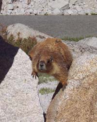
Marmots
and Mosquitos
Above 11,000 feet, the marmots are more of a problem than the bears.
These fury little critters act cute, but if you drop your guard
for a minute they will devour your food with the grace and speed
of a garbage disposal. Hang all your food and anything scented (toothpaste,
sunscreen, garbage) from a large boulder or, better yet, bring a
bear canister (for rent at the ranger stations).
During a one month period around June and July, the mosquitos are
so dense that even repellent may not prevent bites. Their arrival
varies from year to year, area to area and depends on the snow year.
Come prepared (especially if you are camping) with long pants, long
sleeves, and DEET repellent and ask rangers and the SuperTopo
forum what the current mosquito conditions are like.
Climbing
Guides
-
Sierra Mountain Center (200 S Main St, Bishop; 760-873-8526).
They guide just about every classic climb in the High Sierra and
every climb contained in the High
Sierra Climbing SuperTopo guidebook. Be sure to check out their great website which is loaded with photos, route descriptions, slide
shows, and extensive gear lists for most classic High Sierra
climbs.
- Sierra Mountain Guides - (312 N Main St, Bishop; 760-648-1122). They teach and
guide all aspects of climbing in the rock, ice, and alpine realms,
as well as backcountry skiing, ski mountaineering, avalanche education
and mountain trekking.
- Mountain
Adventure Seminars - (209-753-6556) Guiding Matterhorn Peak, Incredible Hulk and other areas in the
Sierra Nevada.
- Sierra Rock Climbing School -
(760-937-0069) Guiding throughout the Sierra as well as Red Rocks, Joshua Tree, Bay Area and more.
Climbing
Gear
There are two great climbing shops on the East Side that have everything
you need for any climbing or backpacking adventure: Mammoth
Mountaineering (361 Old Mammoth Rd, Mammoth Lakes; 760-934-4191)
has ever type of backpacking and climbing gear you will need as
well as rentals of
climbing shoes, sleeping bags and other backcountry gear. Wilson's
Eastside Sports (224 North Main Street, Bishop; 760-873-7520)
has an extensive collection of climbing and backpacking
gear.

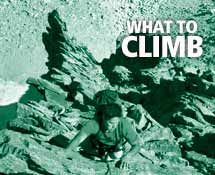
East
Side Summer Cragging Areas
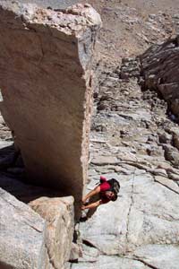
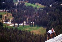
First-rate cragging abounds on the East Side. It is a good idea
to crag at high elevation before climbing a High Sierra route to
both acclimatize and get comfortable on sierra granite. The areas
listed below are between 8,000 and 10,000 feet and are climbable
from May-October. There are a number of other crags and boulders
at lower elevations such as the Buttermilks, Happy Boulders, and
Owens River Gorge. These areas are too hot in the summer.
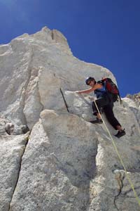
Whitney Portal: Great climbing... if you climb 5.10 or harder.
The rock and lines are as good as Yosemite and present a mixture
of splitter cracks and face moves on 80-degree white granite walls.
The season is spring and fall and unfortunately there is not a good
guidebook to the area.
Cardinal Pinnacle: Another great area... if you climb 5.10
or harder. The fine-grained granite has numerous edges and splitter
cracks. The routes are all 3-4 pitches and end on a cool summit.
The guidebook is Bishop
Area Rock Climbs by Marty Lewis.
Rock Creek/Iris Slab: Rock Creek has excellent (hard) bouldering
along the river and super fun sport climbs on perfect granite edges
(there are not many routes under 5.10). Iris Slab has more easy
and moderate climbs. The guidebook is Bishop
Area Rock Climbs by Marty Lewis.
Dike Wall and Crystal Crag: Located above beautiful alpine
lakes and easily accessed, the Dike Wall has excellent 5.10 and
up sport climbs. Crystal Crags has more moderate climbs also of
excellent quality. The guidebook is Mammoth
Area Rock Climbs by
Marty Lewis and John Moynier. |