Trip Report
Banner Peak, East Corner
Sunday August 14, 2011 4:53pm
Inspired by this trip report, we decided to check out Banner Peak's East Corner. Fiddler & Moynier called it (III, 5.7) and we figured it would be uncrowded and beautiful -- we were not disappointed.

Thursday we attempted to get a day-of-issue permit to enter Agnew Meadows at the Mammoth ranger station, but settled on Rush Creek instead. It promised to be a long approach .. 10 miles and ~4000' of elevation gain. We were not disappointed on that account either :)

top left corner top right corner
Rush Creek trail, Carson Peak in background
Credit: rhyang
bottom left corner bottom right corner

top left corner top right corner
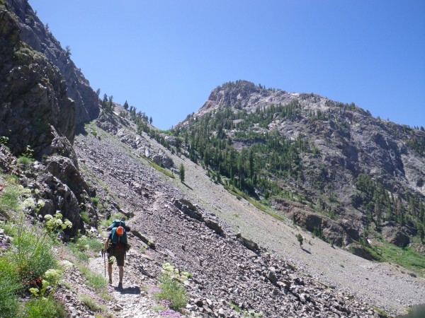
Justin hiking up the steep trail to Spooky Meadow from Agnew Lake
Credit: rhyang
bottom left corner bottom right corner

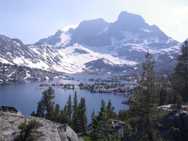
We took the PCT to Thousand Island Lake to avoid a reputed deep creek ford at the Garnet Lake outlet. I was pretty beat by the time we got to Garnet Lake.

top left corner top right corner
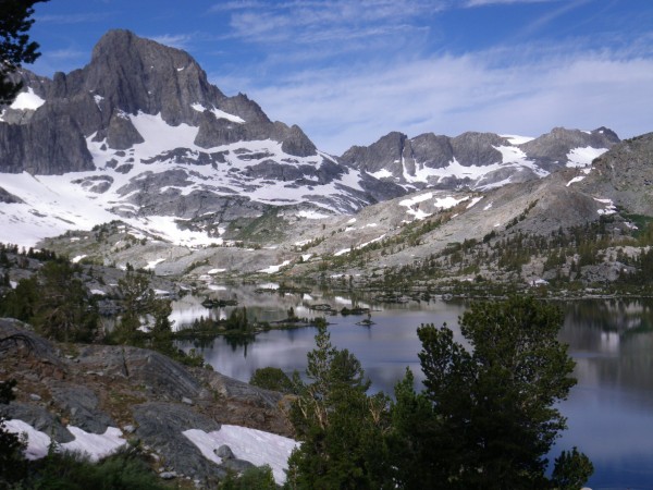
Banner Peak, above Garnet Lake
Credit: rhyang
bottom left corner bottom right corner

We camped off the JMT above the south shore. We knew our approach would be longer in the morning, but oh well. I'd been wearing light mountaineering boots instead of my usual approach footwear, so my feet were a little sore.

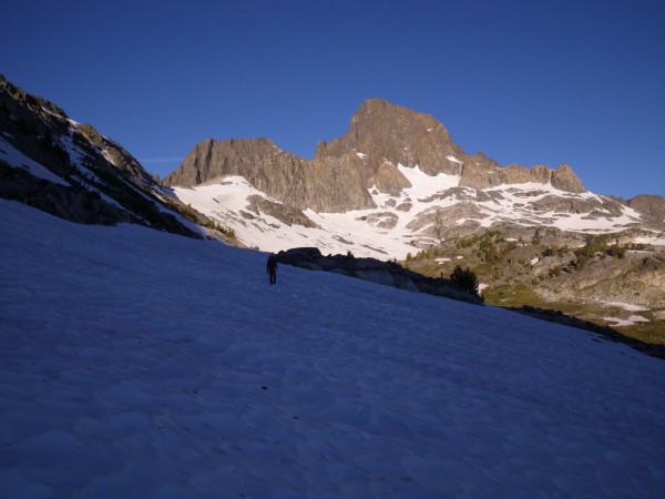
Friday morning at 4:30am arrived all too soon. We got moving before dawn and traversed around the lake.

top left corner top right corner
Justin on the approach
Credit: rhyang
bottom left corner bottom right corner

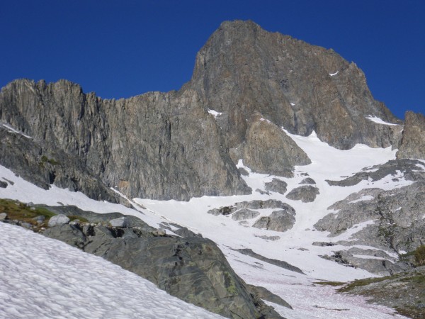
Above the lake the snow was runnelled and suncupped, making for a strenuous approach. We aimed for the saddle between Banner and peaklet 11440'. This saddle can also be approached from the Lake Ediza side.

top left corner top right corner
Approach was mostly snow above the lake
Credit: rhyang
bottom left corner bottom right corner

top left corner top right corner
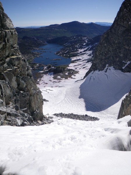
Garnet Lake, from the start of the route (loose chute)
Credit: rhyang
bottom left corner bottom right corner

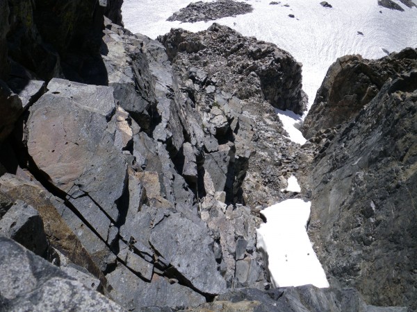
The chute was loose, as advertised. We made our way up and spied the chimney with a chockstone lodged in it, guarded by a tongue of snow. The fourth class to the right of it was not bad, though I started to curse myself for not wearing my approach boots. Justin had no complaints in his Trangos though.

top left corner top right corner
Looking down fourth class section of chute
Credit: rhyang
bottom left corner bottom right corner

We stopped at a decent-looking platform where someone had rigged a bail sling & ring. Looking down the other side we saw some more bail slingage, so we figured we couldn't be that far off. Justin led up the first pitch and we swapped from there.

top left corner top right corner
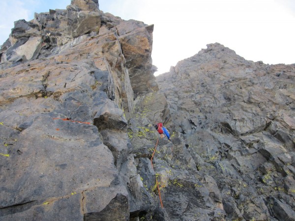
Justin on first pitch
Credit: rhyang
bottom left corner bottom right corner

top left corner top right corner
Thousand Island Lake, from second pitch
Credit: rhyang
bottom left corner bottom right corner

top left corner top right corner
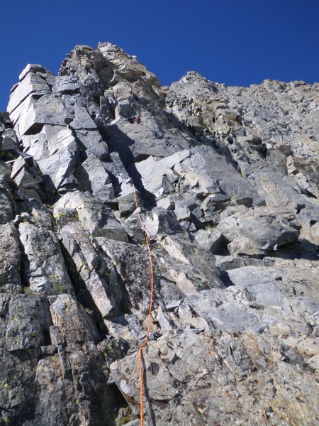
Third pitch
Third pitch
Credit: rhyang
bottom left corner bottom right corner

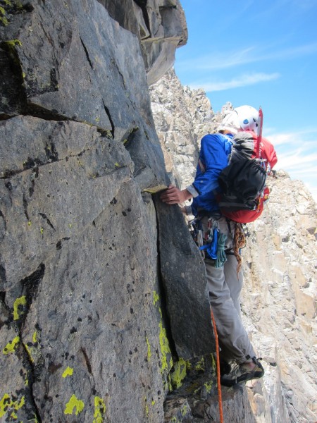
The fourth pitch seemed to have the "crux" traverse. I clipped a Cassin piton (and backed it up with a nut :) and it felt pretty reasonable. The steep climbing above the traverse felt harder, and I felt the weight of the crampons & mountaineering boots in my pack. Hey, I can make excuses with the best of them :)

top left corner top right corner
Me on fourth pitch traverse
Credit: Justin Marion
bottom left corner bottom right corner

Did I mention how great the views were ?

top left corner top right corner
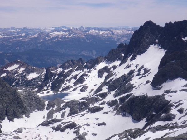
Clyde Minaret and Cecile Lake, from the route
Credit: rhyang
bottom left corner bottom right corner

top left corner top right corner
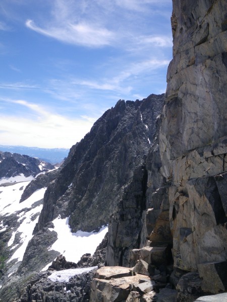
Mt. Ritter, from the route
Credit: rhyang
bottom left corner bottom right corner

There was another traverse around an overhang on a tower, and as luck would have it I got this pitch too.

top left corner top right corner
Me on another traverse pitch (#6 I think)
Credit: Justin Marion
bottom left corner bottom right corner

top left corner top right corner
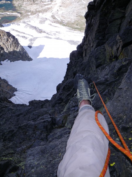
Looking down pitch 6
Credit: rhyang
bottom left corner bottom right corner

We continued meandering up, and like bearbnz started to wonder how long this thing actually was ..

top left corner top right corner
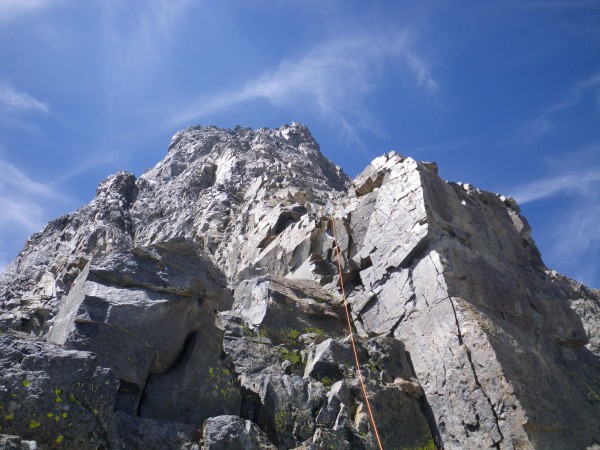
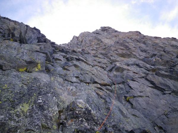
Looking up pitch 7 (Justin's lead)
Credit: rhyang
bottom left corner bottom right corner

top left corner top right corner
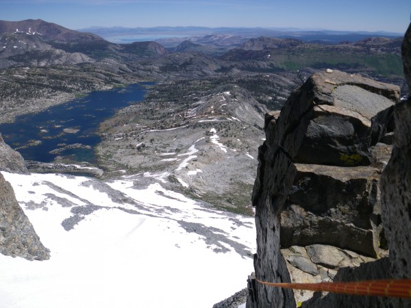
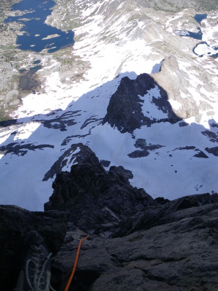
Looking down pitch 8; Garnet Lake in upper left, Nydiver Lakes in uppe...
Looking down pitch 8; Garnet Lake in upper left, Nydiver Lakes in upper right.
Credit: rhyang
bottom left corner bottom right corner

On a big ledge I spied the remains of a rusty old tin can. You know they didn't just bring that for snacks :)

Justin led the ninth pitch, which had some really nice climbing. I was getting quite fatigued at this point, but fortunately there was only a half pitch of easy fifth to the summit. And muchly we rejoiced.

top left corner top right corner
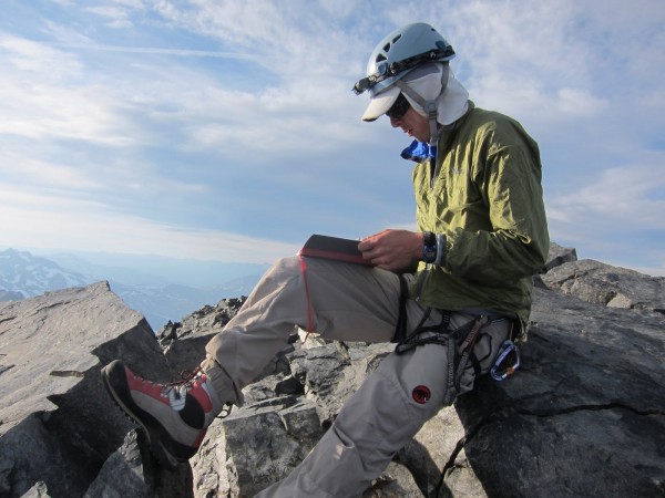
Me perusing summit register
Credit: Justin Marion
bottom left corner bottom right corner

top left corner top right corner
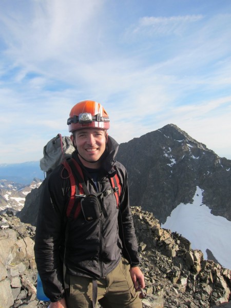
Justin on summit; Mt. Ritter's north face in background
Credit: rhyang
bottom left corner bottom right corner

It was about six-ish, and Justin strapped his headlamp to his helmet, knowing full well what the descent could entail. We made our way down the scree and talus of Banner's SW slope to the Ritter / Banner saddle and made use of our snow gear.

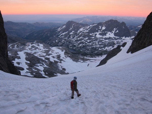
I'd been up the R/B saddle about 7 years ago from the Ediza side and remember it as being kind of steep in places. The top hundred feet or so reinforced that recollection. I'd lamented my choice of footwear for most of the climb, but now I was glad. The lower part was obnoxiously runnelled and suncupped.

top left corner top right corner
Me descending Ritter / Banner saddle
Credit: Justin Marion
bottom left corner bottom right corner

top left corner top right corner
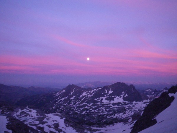
Full moon, and did we ever need it
Credit: rhyang
bottom left corner bottom right corner

Our headlamps switched on around 8:30pm. As we neared the moraine below we contoured northeast along steep snow slopes toward the saddle where we'd started the route. We were both pretty beat. Thank you Moon Goddess for your unearthly light, for we are grateful.

The way back to camp in the dark on alternating snow slopes, talus, slabs, bushes and through the woods was "interesting", to say the least. Generally I bring along a small GPS just for making & navigating to waypoints and otherwise use map & compass, but in this case the device meant the difference between a long walk back to camp and a forced bivy.

Oh yeah, another great time in the mountains :) We turned in after midnight and slept in the next morning. And what an outstanding morning it was.

top left corner top right corner
Taking in the beauty of Garnet Lake
Credit: rhyang
bottom left corner bottom right corner


Gear notes:

 6 or 7 trad draws (shoulder length)
 double-length sling
 2 cordelettes
 Wild Country Rocks 1-8
 cams from WC zero #5 up to 3.5 tech friend (basically 0.6" - 3")
 9.5mm x 60m rope

Yeah, I know .. we brought too much :)
  Trip Report Views: 5,080
rhyang
About the Author

Comments
Zander

climber
  Aug 14, 2011 - 05:06pm PT
rhyang,
Great trip report. I was thinking about doing this as well. Thanks for posting. I was asking a friend this week if he wanted to do it. He pulled out his Roper- The Climbers Guide To The High Sierra. It is called 4th class there. His notes written in the margin were, "1979, long route, some fifth class".
Climb on!
Zander
Dirka

Trad climber
Hustle City
  Aug 14, 2011 - 05:27pm PT
Whoot Whoot!
Crimpergirl

Sport climber
Boulder, Colorado!
  Aug 14, 2011 - 05:38pm PT
Beautiful!
TYeary

Social climber
State of decay
  Aug 14, 2011 - 07:22pm PT
Very cool. Thanks for posting up!
TY
Roxy

Trad climber
CA Central Coast
  Aug 14, 2011 - 07:27pm PT
awesome!!!!11111
10b4me

Social climber
Lida Junction
  Aug 14, 2011 - 08:13pm PT
Rob, you really climb some nice stuff.
bearbnz

Trad climber
East Side, California
  Aug 14, 2011 - 09:13pm PT
Hey Rob, Nice job! I have very fond memories of this climb. A spectacular setting, moderate climbing, moderate approach, and no people. What else could you want?
le_bruce

climber
Oakland, CA
  Aug 15, 2011 - 03:56pm PT
The photos of the sunset and moonrise are beautiful. Great TR - thank you.
nutjob

Sport climber
Almost to Hollywood, Baby!
  Aug 15, 2011 - 04:29pm PT
Spectaculario. More fuel for day-dreams!
JEleazarian

Trad climber
Fresno CA
  Aug 15, 2011 - 05:20pm PT
I've been eyeing that ridge since I first backpacked to Thousand Island Lake in 1968. Thanks for the TR and the excellent pics. How did the Direct East Face look?

John

Darwin

Trad climber
Seattle, WA
  Aug 15, 2011 - 08:55pm PT

The real deal!

I like your writing style, and like Crimpergirl said, beautiful.
haishan

Trad climber
CA
  Aug 16, 2011 - 03:31pm PT
Nice work and great photos Rob... we climbed this on 4th of July weekend, 1000 island was still completely frozen and the approach chute was filled with snow! Great route, but i found lower half to be a bit unnerving with all the loose blocks... upper half (past the steep section) more solid. We thought the ediza approach from agnew worked well too.
msiddens

Trad climber
  Aug 16, 2011 - 05:09pm PT
kick-a** Rob, way to put it together.
Gene

climber
  Aug 16, 2011 - 05:11pm PT
Great job, Rob. TFPU!

I love that rubble pile and its neighbor.

g
jfailing

Trad climber
PDX
  Aug 16, 2011 - 06:09pm PT
That shot of the sunset is amazing - great TR!
atchafalaya

Boulder climber
  Aug 16, 2011 - 06:38pm PT
Awesome, that Rush Creek approach always kicks my ass. Thanks for the tr.
rhyang

climber
SJC
Author's Reply  Aug 17, 2011 - 10:13pm PT
Thanks all !

John, I didn't see a listing for the "Direct East Face" in Secor or any of the other guidebooks. Maybe we have high-res pics that would answer your question if you remind me via email.
Bad Climber

Trad climber
The Lawless Border Regions
  Aug 17, 2011 - 11:16pm PT
Thank you! Beeeeoooooteeeefullll.

BAd
survival

Big Wall climber
Terrapin Station
  Aug 17, 2011 - 11:34pm PT
TRIP REPORT WOOOOO HOOOO!!!


MOUNTAINS WOOOOO HOOOOOO!!!!


AWESOME PIX WOOOO HOOOOOO!!!!
mtnyoung

Trad climber
Twain Harte, California
  Aug 18, 2011 - 09:43am PT
Very nice trip report, Rob. It seems like you're getting around quite well now?
Go