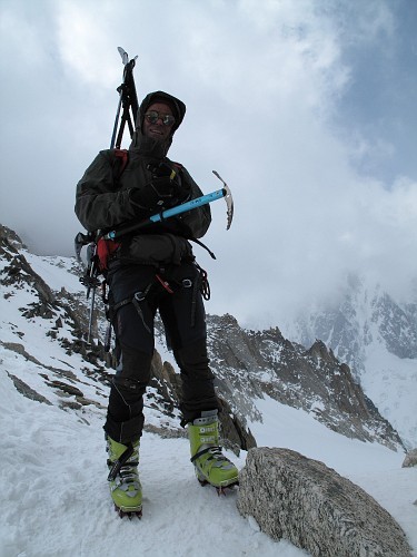
More Details (disclaimer: my spelling is really poor):
The group was 100% internet organized and included a brit whom I met for the first time the day before we started named Pete from summitpost.org and an Italian I met a while back and have skied with before from crinale.it. The Brit is Peter and the Italian is Roberto.
Due to my work schedule on the front end of the week and theirs on the tail end, we had exactly enough days to do the tour but not a day more (not a good plan but he who not try fails for sure). Roberto and I left from our places of work around 5 pm for a linkup prior to the Mt Blanc tunnel (saving money and emmissions) and proceeded to Peter's place in Argentiere.
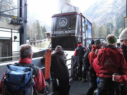
We drank beers until well after midnight and then fell asleep with a loose plan to eat some breakfast and head up on the first car of the Gran Montets:
 |
||
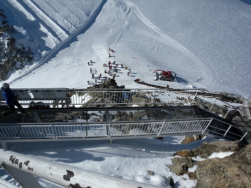
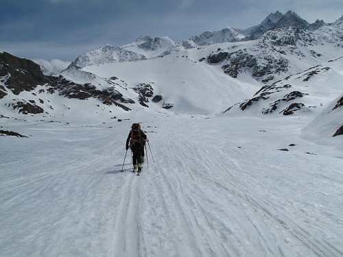
At the top of the lifthouse, there is a great view of the Gran Montets ski area which has some really good touring kick off options as well as great difficult on and off-piste skiing. As you can see, the weather is perfect and we were not alone at the exit point onto the piste.
 |
||
Looking back to the West, you can see all of Chamonix valley from the panoramic platform... there is that old wive's tale about mare's tales... the high cirrus was starting to form but all seems ok.
 |
||
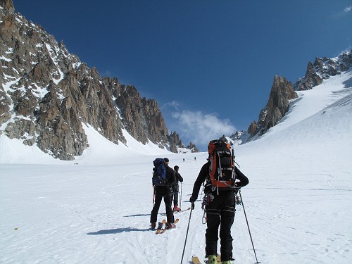
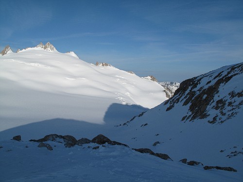
After skiing the first steep headwall toward the Argentiere galcier, we ventured off piste - 5 mins in and we are on the glacier. This are looking up. The first objective is the ski onto and across the Argentiere glacier to the base of the rock bands in the pic below. That marks the beginning of the climb to the col du Chardonet which is the main col in the center of the photo (the actual col is just out of sight).
 |
||
Looking back up the Argentiere glacier (looking south toward Italy)
 |
||
Grand Montets headwall with 'the Verte' colouir visible. Our descent from the lift station is just out of sight to the right.
 |
||
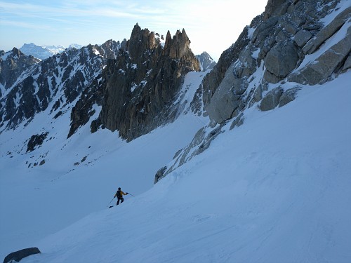
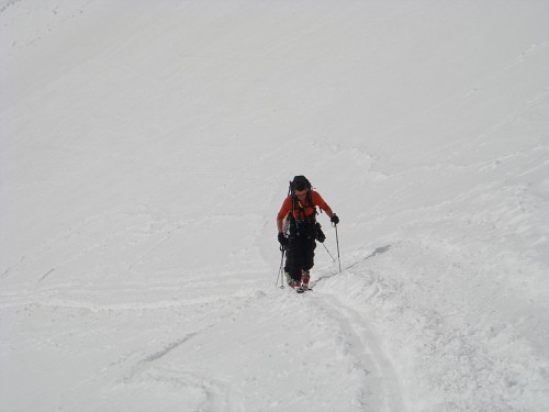
After donning climbing skins and ski crampons, we made our way up toward the col. The climb actually started with a bit of 'boot camping' as Pete calls it up through the rock bands. It is likely possible to ski it but there are too many boot holes to make the crampons reliable and skins are useless. Here Pete is just past where we put skis back on and started to skin toward the col. Of note are the clouds just becoming visible on the left side of the photo where the ridge meets the sky.
 |
||
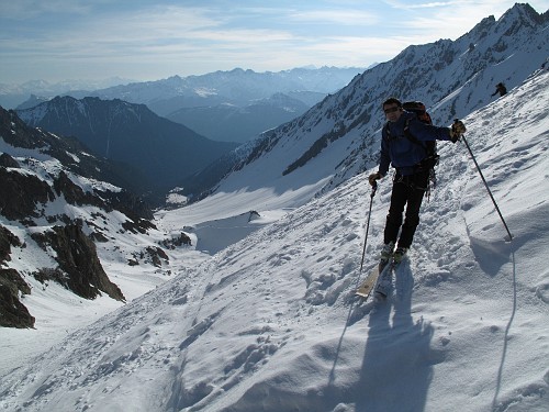
The climb widens and the grade eases - time to disengage the crampons and finish the climb (after all the euros take their first smoking break, of course)
 |
||
Roberto standing at the top of the Col du Chardonet preparing to descend the fixed ropes onto the Saliena glacier.
 |
||
Pete and I looking down the fixed rope to the Saliena glacier from the Col du Chardonet.
 |
||
After the fenetrie de saliena (another col), we started the gentle descent across the Plateu du Trient toward the hut - here is the first glimpse of some weather coming in.
 |
||
No problems though, the hut was just about half an hour away (visible on the top of the rock band).
 |
||
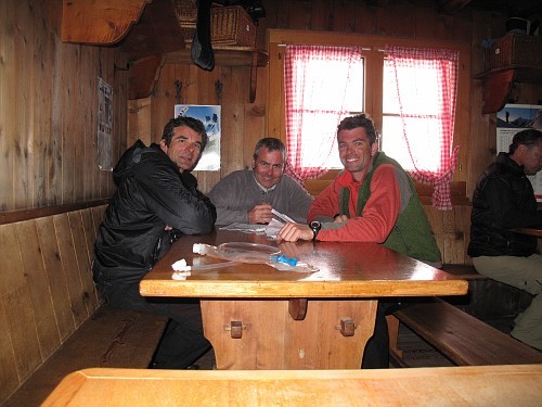
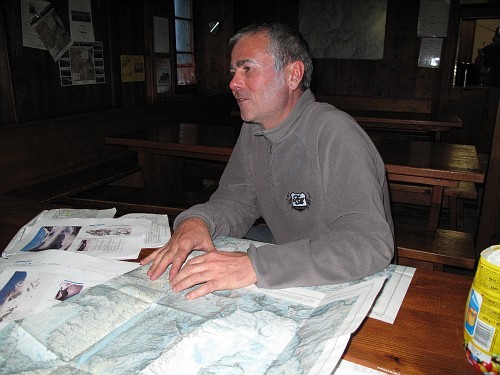
The Trient hut is a pretty standard for Swiss hut - spectacular scenery, great food and comfortable accomdations.
 |
||
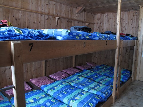
And of course, a super comfortable bunk room
 |
||
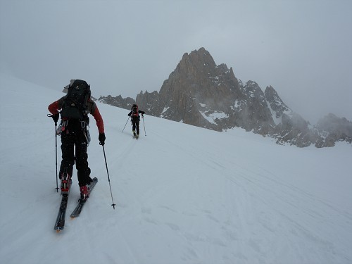
Shortly after we arrived, the weather went south. There were periods of total whiteout followed but partial vis but all the while parties kept arriving - many looking pretty relieved to find the place. Skiing the Plateau du Trient in poor weather is pretty straightforward if you have a compass bearing from the col but...
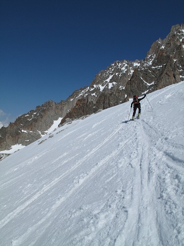
Interestingly, the forecast was supposed to just get worse and worse but when we woke up the next day, it was perfectly calm and clear. Here I am stadning out front getting ready to strap the skis on for a big day. The normal route description for both the classic and Verbier versions calls for you to head down to the val d'arpette to Champex and then travel on the Bourg Saint Pierre followed by doing the climb up out the next day. We decided to combine the two since otherwise we would be pushing out luck with the weather if we did not and it also seemed that it would be two short days.
 |
||
The descent from the Trient hut starts by picking your way throught the rocks in the foreground of this shot and then directly to the toe of the ridge that it is in the shade. There, you go around the toe to a steep headwall.
 |
||
After turning the corner, you can see the col du Ecandines which guards the entrance to Val D'arpette and the Trient glacier. I managed to punch through a crevasse here up to my waist, popping a ski in the process, which luckily was not too deep. Now wide awake, we finshed the headwall and made way toward the col.
 |
||
The ski track from the initial headwall descent to the col is visible here. You kick steps up for the final portion for about 60-70m and then stare down Val D'arpette to Champex, CH - 1300m below.
 |
||
Pete starting the descent - Champex is down and to the right below the woods.
 |
||
Just above town, the snow was a bit thin but still skiable. That problem has been temporarily fixed now thanks to the ongoing massive storm.
 |
||
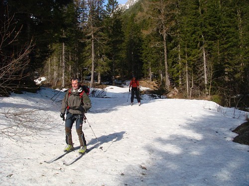
We had a fantastic breakfast while waiting to catch a bus (I know, we are pansies) to the bourg st pierre trailhead and started the next phase - a 1700m climb to the Valsorey Hut.
 |
||
The climb starts up the flats toward Mount Velan:
 |
||
There are massive slides on the other side of the river but that did not seems to deter a few from using that bank for the descent! There is a bit of an eerie feeling when you are continuously skiing trough avalanche debris at the base of a huge unstable snowfield but hey, they seemed to dig it.
 |
||
The climb to the hut goes to the Velan headwall and then snakes through a massive slot canyon before the final part of the climb. In all it takes about 4.5 hours and I cant honestly say it is pure bliss.. Here I am nearly finished and Pete is kicking my ass with a relenting pace
 |
||
Finally we reached the Valsorey hut and some pretty massive clouds were spilling into the valley.
 |
||
Having been told that there was a massive system coming, we decided to mark some key spots on the route in hopes we could duck out extra early and cross the Plateu Colouir and get onto the descent toward the Chanrion hut before the bad weather set in
 |
||
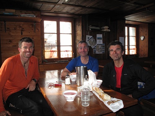
The hut there is amazing. The climb there pretty much kicks your ass but that is nothing a few liters of fruit tea, bread, cheese and prscuitto wont fix. Here we are looking pretty optimistic after the climb and before dinner.
 |
||
After a few bottles of swiss red, we went to sleep. There was surely plenty of cloud and a light breeze but nothing abnormal. I woke up at midnight and realized that we might have an interesting morning. The winds were surging violently and the hut was getting hammered. We still woke up at 5:30 for breakfast but then decided to call it (along with a group guided by Cathy Cosley and Mark Houston who were the only others in the hut). Here is teh scene in the AM
 |
||
We set off and it was getting progessively worse. We found out way through the bands of cliff below the hut without too much drama and got into the slot canyon - at least we were throught the bulk of the route finding- conditions here were at least sane:
 |
||
As we walked down the valley, it seemed that the weather was not all quite here yet - only a light snow and some wind but it was surely on its way. We made the right call but it is never easy to bail on a route like that.
 |
||
Oh well... next time. If the second half of the route is any bit as good as the first, it is surely worth all the hype!